Nar Phu Teri La Upper Mustang Trek
Request a Quote (?)
- Satisfied Client
- Personalised Guide
- Instant Response
Get Instant Response:
+977-9851329446 (Whatsapp)
| Starts at: Kathmandu | Ends at: Pokhara |
| Trek Region: Annapurna | Transport: Tourist Bus |
| Duration: 24 Days | Trip Grade: Strenuous |
| Max Altitude: 5595 m / 18356 ft (Teri La Pass) | Accommodation: Teahouse / Camping |
Nar Phu Teri La Upper Mustang Trek Highlights
- Crossing the Teri La Pass connecting Manang with Upper Mustang.
- Hiking through highly remote areas devoid of human settlements.
- Fabulous views of Annapurna, Dhaulagiri, Machhapuchhre, and Manaslu mountains.
- Wilderness camping for the majority of the days.
- Visiting many monasteries and meeting Buddhist monks.
- Experiencing how local farmers, herders, and traders live – as they have for generations.
- Contemplate how difficult the trade routes between Tibet and Nepal were for traders in the past.
- Visit Lo Manthang – an ancient walled city and home to the King of Lo until 2008.
- Explore the sky caves at Chhoser.
- See strange clay effigies in the covered alleyways of Kagbeni.
- See one of the largest gorges in the world – the Kali Gandaki.· Trek through apple orchards, pine, forests, pastures, and canyons of high rocks and desolate lands.
Nar Phu Teri La Upper Mustang Trek is for you if you love strange, often lunar-like landscapes, high snow-capped mountains, learning about new cultures, and seeing how people live in remote and often stark places.
Nar Phu Teri La Upper Mustang is an expedition-style partly camping trek with an average of 6 to 7 hours of hiking daily. With some high passes to cross and over 3 weeks in length, this is not a trek for the novice hiker. A great fitness and stamina level is required, previous hiking experience is highly recommended, and a sense of adventure and open-mindedness is pretty much compulsory to get the most out of this experience.
It is possible to do the Nar Phu Teri La Upper Mustang Trek in one of two directions, but the one we chose offers the best acclimatization options. Make no mistake: This is a high-altitude trek, with most days above 3,000m / 9,842.5 ft and sleeping for half a dozen nights at altitudes over 4,000 m / 13,123 ft. Crossing the Teri La Pass (5,595 m / 18,356 ft) is not easy but certainly thrilling.
This isolated trek takes you into Manang and both Upper and Lower Mustang. There are no settlements in some parts of the trek; you are alone with your experienced trekking team for days. In other parts, you will cross onto more popular trekking routes and encounter other trekkers and comfortable lodges.
The mountains in this area are particularly spectacular, most likely because of your proximity. The landscape ranges from forests, rivers, cultivated lands, and pastures to dry lunar-like landscapes with high rocks and cliffs reminiscent of Tibet.
In fact, this area’s main culture and religion is Tibetan Buddhism. You will visit Lo Manthang, the ancient walled city, home to the King of Lo. This is the spiritual heart of Upper Mustang and fascinating to visit. Equally fascinating are the sky caves nearby.
Note: A shorter trek into the Nar Phu Valley is also available with us should you feel this one is too strenuous and/ or too long.
Nar Phu Teri La Pass Trek Outline Itinerary
Day 1: Kathmandu to Khudi (Drive)
Khudi – 2626 m / ft – 7 hrs
Day 2: Khudi to Sirung
Sirung – 1220 m / 4002 ft – 7 hrs
Day 3: Sirung to Jagat
Jagat – 1300 m / 4265 ft – 6 hrs
Day 4: Jagat to Dharapani
Dharapani – 1830 m / 6003 ft – 7 hrs
Day 5: Dharapani to Koto
Koto – 2610 m / 8891 ft – 6 hrs
Day 6: Koto to Meta
Meta – 3560 m / 10826 ft – 7 hrs
Day 7: Meta to Phu
Phu – 4250 m / 11614 ft – 7 hrs
Day 8: Acclimatization Day
Phu – 4250 m / 11614 ft – 2 hrs
Day 9: Phu to Nar
Nar – 4110 m / 13484 ft – 6 hrs
Day 10: Nar to Yak Kharka
Yak Kharka – 4400 m / 14435 ft – 6 hrs
Day 11: Yak Kharka to Lapse Khola
Lapse Khola – 4500 m / 14763 ft – 6 hrs
Day 12: Lapse Khola to High Camp
High Camp – 4900 m / 16076 ft – 5 hrs
Day 13: High Camp to Pasphu Khola Camp via Teri La Pass
Pasphu Khola Camp – 4730 m / 15518 ft – 9 hrs
Day 14: Pasphu Khola Camp to Yakpa
Yakpa – 4300 m / 14107 ft – 6 hrs
Day 15: Yakpa to Tange
Tange – 3300 m / 10826 ft – 5 hrs
Day 16: Tange to Yara
Yara – 3600 m / 11811 ft – 6 hrs
Day 17: Yara to Lo Manthang
Lo Manthang – 3770 m / 12368 ft – 6 hrs
Day 18: Day Trip to Chhoser Cave
Lo Manthang – 3770 m / 12368 ft – 6 hrs
Day 19: Lo Manthang to Dhakmar
Dhakmar – 3810 m / 12500 ft – 7 hrs
Day 20: Dhakmar to Ghiling
Ghiling – 3806 m / 12486 ft – 6 hrs
Day 21: Ghiling to Chuksang
Chuksang – 3050 m / 10006 ft – 6 hrs
Day 22: Chuksang to Jomsom
Jomsom – 2700 m / 8858 ft – 6 hrs
Day 23: Jomsom to Pokhara (Drive)
Pokhara – 830 m / 2723 ft – 7 hrs
Not satisfied with this Itinerary?
Are you interested on planning custom trip? It only takes 2 minutes.
Day 1: Kathmandu to Khudi
- Drive time: 7 to 8 hours
- Accommodation: Tea House
- Distance: 190-200 kilometers (118-124 miles)
Today, you catch a local bus to Besishahar along the highway that leads to Pokhara but turn off well before the lakeside town. Then, change transport at Besishahar for a local bus or jeep for a half-hour ride to Khudi.
This small town is situated on the Marsyangdi River and has a few guesthouses and lodges as it is a popular stopping point for the Annapurna Circuit Trek.
Day 2: Khudi to Sirung
- Drive time: 7 hours
- Accommodation: Tea House
- Distance: 8 km / 5 mile
You get your first introduction to Nepal’s suspension bridges today as you cross the tributaries of the Marsyangdi River. Watch out for some stunning waterfalls as you make your way up and down the trail. But mostly up!
The ethnic communities in this area are mainly Tamang. One of the largest ethnic groups in Nepal, they are thought to have originated from Tibet.
The name Tamang means ‘horse trader’ in Tibetan, which indicates this may be the case. Their Tibeto-Burman language is related to the language spoken by Nepal’s Gurung community, who migrated from Tibet hundreds of years ago. Sirung village is, however, inhabited by mainly Gurungs.
The mountains you get the best views of today are Manaslu and Ngadi Ghuli.
Day 3: Khudi to Sirung
- Drive time: 4 hours
- Accommodation: Tea House
- Distance: 15 km / 9.3 miles
After breakfast, you follow the Marsyangdi River through a gorge. When you emerge from the gorge, you enter a fragrant pine forest.
Today’s mountains are Manaslu and Annapurna II, while culturally, you can visit Chyamche village. If you pay close attention, you may notice that Chyamche marks the end of the dominantly Gurung culture of the Lamjung district and the beginning of the Tibetan-influenced culture of the Manang district. Your guide will point out the now flat-roofed houses built in traditional stone.
It is likely we will stop here for lunch before heading on to Jagat.
Day 4 :Jagat to Dharapani
- Drive time: 7 hours
- Accommodation: Tea House
- Distance: 15 km / 9 miles
Today, there are more suspension bridges to cross and a green valley. Along the river, you will see a few waterfalls, the sounds of which are a peaceful respite on this sometimes steep and slippery trail with stark rock formations.
Today, you enter the district of Manang, and there is a welcome gate to greet you. Once you reach Dharapani, your trekking permits will be checked.
Day 5: Dharapani to Koto
- Drive time: 6 hours
- Accommodation: Tea House
- Distance: 7 km / 4.3 miles
Following the Marsyangdi River, the Annapurna and Manaslu ranges loom over you as you climb upwards through pine forests.
Today, you will stay in the village of Koto, which has traditional houses. You have plenty of time to explore around Koto.
Day 6: Koto to Meta
- Drive time: 7 hrs
- Accommodation: Tea House
- Distance: 14.5 km / 9 miles
Today, we branch off the Dhaulagiri Circuit, which we have been following so far, and start onto the Nar Phu Valley trek route. Another check post indicates this, which will ensure you have the proper paperwork for this restricted area.
This is a strenuous day of following the river, which we will cross again by suspension bridges and through forests. No suitable places are available, so you will have a packed lunch with you today.
After the village of Dharmasala, there is a steep climb up until Meta. From here, Annapurna II and the Lamjung Himal mountain range are in view.
Day 7: Meta to Phu
- Drive time: 7 hrs
- Accommodation: Camping
- Distance: 16.5 km / 10.2 miles
This is another long and strenuous day, and with the altitude now over 4,000 m, you may feel the effects on your body. Taking it slowly but steadily is the key to a successful trek today.
Leaving Meta, you encounter Buddhist chortens that this area is well-known for. In the distance you can see the Nar Phedi Monastery. Following the Phu Khola (river) there are more suspension bridges to negotiate, and views of Pisang Peak and Annapurna II to enjoy.
After the strenuous hike through canyons and along tricky rocky trails, and just before the final ascent up to Phu, there are the remains of forts, known as dzong, which are reportedly the remains of a Khampa settlement.
Khampa are people from Kham in Tibet who have a long trade history with Nepal. However, conflict arose in the 18th century over trade routes, political instability in Tibet, and Khampa raids into Nepal. Guerrilla warfare took place, but in the end, the Gorkha peoples, under King Prithvi Narayan Shah, prevailed and ‘retook’ Mustang from the Khampas.
Around the 1950s, with the Chinese occupation of Tibet, there were also some skirmishes on the Nepal border here with the Khampas. But history is hazy.
Day 8: Acclimatization Day in Phu
- Drive time: 2 hrs
- Accommodation: Camping
- Distance: 3 km / 1.8 miles
Now, you can really feel like you are in Tibet, with a landscape of layered rock and little vegetation. Here in Phu village, the locals either migrated from Tibet themselves or are descendants of those who did, particularly during the 1950s.
The culture of this village is still very much as it was in the past—Tibetan lifestyles and beliefs. The houses are Tibetan-style stone with flat roofs. The main occupation of the locals is herding—you may see herds of yaks, blue sheep, and goats.
The landscape around the village is dominated by the peaks in the Annapurna and Dhaulagiri ranges. The hills are grey and stark, reflected in the stones used to build the houses.
After a leisurely breakfast, you can learn more about this area’s incredible history and take a short hike to Tashi Lhakhang Gompa (monastery).
Here you may be lucky to meet Karma Sonam Rimpoche. There is little available information on whether he is still living, so if you meet him, please let us know. The Rimpoche reportedly fled from Tibet to India with the Dalai Lama in 1959 before he came to Tashi Lhakhang Gompa.
If you are feeling energetic, you can spend around four hours hiking to Himlung Himal Base Camp, where you can see more stunning views and herds of blue sheep.
Day 9: Phu to Nar
- Drive time: 7 hrs
- Accommodation: Camping
- Distance: 13 km / 7 miles
Today, start early to trek a long path to Nar. Although today’s route is again challenging, and even tougher as you are still at high altitude, the sense of achievement is fantastic—almost as fantastic as the views of the Annapurna and Manaslu massifs you will see today.
The final part of the hike takes place after crossing Nar Phedi village. The winding path is relatively gentle and passes some interesting chortens (stupas) on the way.
Nar is an interesting village, with the traditional sitting alongside the new, quite comfortable teahouses with menus meant for foreign trekkers. Here again, the local population is mainly of Tibetan heritage, with Tibetan Buddhist customs and beliefs. You will find the Tashi Lhakhang Monastery and Nar Phedi Monastery nearby, which again offer an insight into Tibetan Buddhism. Terraced fields and green pastures indicate the occupation of this village.
Day 10: Nar to Yak Kharka
- Drive time: 9 hrs
- Accommodation: Camping
- Distance: 20 km / 13 miles
After breakfast made by your amazing camp chef, start hiking through pastures and forests while surrounded by stunning mountains.
Day 11: Yak Kharka to Lapse Khola
- Drive time: 5 to 6 hrs
- Accommodation: Camping
- Distance: 8 km / 5 miles
After breakfast, you follow the Phu Khola River, passing pastures of grazing yaks and goats. The trail is relatively flat at this point, but you will have to descend as you go further into the valley.
The views of the mountains continue to be spectacular, and today, you may encounter waterfalls along the trail, which adds to the beauty around you.
Lapse Khola is basically a herder’s settlement and it is interesting to see how the herders live daily.
Day 12: Lapse Khola to High Camp
- Drive time: 5 to 6 hrs
- Accommodation: Camping
- Distance: 6 km / 4 miles
After another breakfast made by your camp chef, as he does every morning, you set out to follow the Lapse Khola (river) to the open area where you will be camping for the night.
With an increase in altitude of around 500 m / 1,640 ft, care must be taken to observe your own body and that of your trekking companions for signs of altitude-related problems.
Day 13: High Camp to Pasphu Khola Camp via Teri La Pass
- Drive time: 8 to 10 hrs
- Accommodation: Camping
- Distance: 13 km / 7 miles
It’s another long and challenging day. The Teri La Pass is 5,595 m / 18,356 ft and will take you around 9 hours to cross. You may start this day before dawn depending on the weather and season.
With scree on the trail and possible snow and ice, care must definitely be taken today. Crampons may be required. Again, on the descent, loose rocks may be among the moraine. As well as being an exciting day on the trek, with panoramic views of the Annapurna range, Tilicho Peak, and Gangapurna, there is a history behind the Teri La Pass
This pass was used as a trade route between Lo, now mostly known as Upper Mustang, and the Nar Phu Valley. Traders carrying salt and other goods traveled this route between the two regions. Imagine crossing this past hundreds of years ago in basic clothing and harsh weather!
Day 14: Pasphu Khola Camp to Yakpa
- Drive time: 8 hrs
- Accommodation: Camping
- Distance: 12 km / 7 miles
Today, you might feel slightly relieved as the altitude and the trail are less difficult than yesterday. You have come out of the areas of stark rock and can enjoy some green pastures and meadows where herders graze their yaks.
The river you are crossing is the Pasphu Khola with its ubiquitous suspension bridges. As you near Yakpa the Samena Khola Valley you are trekking through becomes wider.
Yakpa is an old Kampa village – again, this area has so much history.
Day 15: Yakpa to Tange
- Drive time: 5 to 6 hrs
- Accommodation: Camping
- Distance: 8 km / 4 miles
Crossing many streams, with Dhaulagiri sitting above you, you may encounter yaks and blue sheep along the way. It is worth noting that salt is found in this area, which puts it on the salt trail map of old.
Day 16: Tange to Yara
- Drive time: 6 to 7 hrs
- Accommodation: Camping
- Distance: 13 km / 8 miles
This is a day of ascents and descents, but you should be used to that by now! This is a rarely used trail, so meeting other travelers on the way would be unusual. The altitude has risen slightly over the previous day and will continue to rise for the next few days. So, care should be taken to stay hydrated and eat well to keep your energy level up.
Day 17: Yara to Lo Manthang
- Drive time: 7 to 8 hrs
- Accommodation: Teahouse
- Distance: 17 km / 10.56 miles
In order to reach the walled city of Lo Manthang in the Upper Mustang, you must cross the Dhi La Pass (3,950 m / 12,959 ft) and the Lo La Pass of a similar height.
Lo Manthang is the ‘walled city’ and was established hundreds of years ago. The Mustang Kingdom came about around the 14th century, with Lo Manthang as its capital. The walls were for defense as they controlled the salt route between Tibet, Nepal, and India.
Many gompas grew up in this area with the growth of Tibetan Buddhism. The 18th century also saw the isolation of Lo Manthang as the country of Nepal was formed more or less as it is today. With this isolation, Lo Manthang could retain its culture and traditions that still stand today. However, with the fall of the Nepal monarchy in 2008, the then King of Mustang, Jigme Dorje Palbar Bista, was obliged to give up his title. Although he died in 2016, the people of this area still very much revere and think fondly of him.
Interestingly, Mustang was only opened to foreigners in the 1990s. Today, the festival of Tiji, celebrated around May each year, attracts hundreds of foreign visitors as well as locals from all over Mustang.
Day 18: Day Trip to Jong Cave, Chhoser
- Drive time: 6 to 7 hrs
- Accommodation: Teahouse
- Distance: 21 km / 13 miles
One of the highlights of the trek is visiting the five-story–high caves! No one knows why these caves were made or exactly when—it is one of the mysteries of Nepal.
After breakfast, it’s a straightforward two-hour hike to the cave, also known as the Sky Cave because of its height off the ground. Jong Cave is definitely a man-made structure with 40 rooms on different levels that are reached by a system of ladders.
In the distant past, sky caves around the world were used as burial chambers, so this is a possibility here too. There has been extensive research done at the Jong Cave, during which 27 human remains with cut marks on their bones were found.
Dated from the 3rd to the 8th centuries it is believed these remains underwent a Bon-Buddhist burial – like a sky burial, which still takes place today in places like Mustang and Tibet. It is also believed the caves were used as hiding places during wars and for storage and military lookouts. Whatever the original purpose, this is a fascinating place to visit in this dry, lunar-like landscape.
Returning to Lo Manthang you can spend the afternoon exploring the town and visiting Thukchen Monastery. Thukchen is the only monastery in the world with 108 mandala murals on the wall.
Day 19: Lo Manthang to Dhakmar
- Drive time: 6 to 7 hrs
- Accommodation: Camping
- Distance: 17 km / 10.5 miles
Leaving the historic walled city behind today we head through the arid landscape among the Buddhist artifacts such as mani walls and prayer flags. Nature has formed many amazing rock formations for you to wonder about – perhaps your mind returns to the wonderful caves you saw yesterday,
Day 20: Dhakmar to Ghiling
- Drive time: 5 to 6 hrs
- Accommodation: Camping
- Distance: 14 km / 9 miles
Crossing the valley and down the ridge, we leave Dhakmar until we reach the Ghiling Valley. The landscape continues to be stark yet beautiful, with its colored rocks and lunar appearance. An interesting feature you will see today is the Ghami Monastery, one of the oldest monasteries in Mustang. Here at Ghami village, cultivated farmlands are set among the high rocks.
Day 21: Ghiling to Chuksang
- Trek time: 7 hrs
- Accommodation: Camping
- Distance: 17 km / 10.5 miles
The scenery is much the same today, with stark landscapes within which the villagers of Ghiling and Chuksang have carved out their fields and preserved their traditions.
Day 22: Chuksang to Jomsom
- Trek time: 8 hrs
- Accommodation: Teahouse
- Distance: 20 km / 12 miles
This is the penultimate day of this fascinating, awe-inspiring, and culturally mind-blowing trek! And there is more in store as you trek down to Kagbeni, which is situated on the banks of the Kali Gandaki River within the river valley. Here, you exit Upper Mustang and enter Mustang, and you are now on the Annapurna Circuit Trek route.
Kagbeni has a monastery, modern restaurants, and lodges that sit side by side. But perhaps most interesting is its covered alleys and strange clay figures found within the alleys.
After lunch here, you can continue your trek down to Jomson, a short walk along a dry river bed, or jump on a jeep if you are looking forward to the facilities Jomson has to offer!
Day 23: Jomson to Pokhara (drive)
- Drive time: 7 hrs
- Accommodation: Camping
- Distance: 158 km / 98 miles
Unfortunately, today, you leave the Nar Phu Teri La Upper Mustang Trek behind and drive to the vibrant city of Pokhara. This is the final day of your trip, and we say goodbye tonight. We hope you enjoy the rest of your stay in Nepal.
Overnight in a very comfortable hotel in Pokhara. Dinner is not included, but breakfast the next day is.
Includes
- 22 nights accommodation in mountain teahouses and tents
- 1 nights accommodation in Pokhara Kuti Resort or similar
- Guide for 23 days
- Cook for 23 days
- Required number of porters for 23 days
- Kathmandu to Khudi local bus
- Jomsom Pokhara flight
- Pokhara Kathmandu tourist bus
- Annapurna conservation area permit
- Restricted area permit
- Trekkers information management system card
- 23 x breakfast, 22 x lunch and 22 x dinner while on the trek
- Lunch and dinner in Pokhara
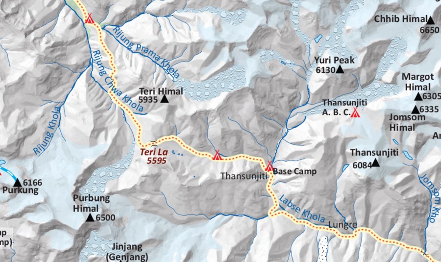
Nar Phu Teri La Pass Upper Mustang Trek Map
A Day on the Nar Phu Teri La Upper Mustang Trek
This is such a varied trek, with changing landscapes and accommodations, that there is no such thing as a ‘typical’ day on it! Which is exactly what the adventurous among you want.
Let’s, take a look at a day when you are camping:
The chef will prepare your breakfast so that when you wake up, you will be greeted by a cup of hot tea. Hot water for washing will also be provided. While you enjoy your breakfast and talk to your guide about the day ahead, the camping crew will start to pack up the tents.
A packed lunch will be prepared and carried with you in the areas where there are not settlements or no settlements with any facilities for trekkers.
After breakfast, head out for some descents and ascents along the trail. You may see rivers and streams, high rock formations, or crossings over mountain passes.
Over lunch you can take in the surrounding mountains and views and stretch out any aching muscles. Then it’s on again, through the wonderful landscape, to the next place where you will spend the night.
The camping crew will have already set up the camp by the time you arrive, and you will be able to have a light snack and tea/ coffee while the chef prepares a hot and wholesome dinner.
Over dinner there is time to reflect on the day before retiring to your tent for the night.
Location of the Nar Phu Teri La Upper Mustang Trek
This trek takes you through Manang, Upper Mustang, and Lower Mustang and on to the lively town of Pokhara. You are in the area of the Annapurna mountain range yet far from the classic Annapurna area treks. We are starting this trek from Manang and ending it in Pokhara, but it is possible to do it the opposite way round. The reason we do it anti-clockwise is that there is more time to acclimatize to the high altitude this way.
Manang – Nar and Phu Villages
The villages of Nar and Phu are found in the Nar Phu Valley of Manang district. Both have Tibetan influences, as the inhabitants mainly come from Tibet. This influence is obvious to even the most casual visitor—the way the people dress, the style of their homes, the many stupas, gompas, and mani walls (walls of stones carved with prayers).
Another interesting fact is that there are some ruins of dzongs (forts), which are reportedly the remains of a Khampa settlement. The Khampa people come from Kham in Tibet and have a long history of trade with Nepal. They also have a history of conflict and guerilla warfare. Even as recently as the 1950s, there were skirmishes on the border, but there is no clear record of the facts.
The main occupation of the people in Nar and Phu and surrounding villages is yak, sheep, and goat herding. They also grow their own grains and limited vegetables. In the past they would have been traders, and perhaps some still do this business.
In Phu, you can find the Tashi Lhakhang Gompa, whose history is also long and shrouded in the mists of time and folklore. This monastery was built by some of the early settlers who came over from Tibet. In more recent times, the Rimpoche was one of the lamas who left Tibet along with the Dalai Lama in 1959.
Nar Phu, or ‘Narpa is a Sino-Tibetan language spoken in both the villages of Nar and Phu. As legend has it, this is to confuse the people of Manang!
Teri La Pass
The Teri La Pass connects Manang to the Upper Mustang and was part of the trading route between the Kingdom of Lo (now Upper Mustang) and the Nar Phu Valley.
Crossing the pass involves a long day of very strenuous trekking over precarious loose ground. There will be scree on the trail and possibly ice and snow which means that you may have to wear crampons. At 5,595 m / 18,356 ft altitude comes into play. Although you will have had plenty of time to acclimatize, it is a tough day. Staying hydrated and going at a steady, not rushed pace will alleviate some of the potential altitude-related problems.
As far as views go from the pass you see the Annapurna range, Tilicho Peak and Gangapurna.
Upper Mustang
Upper Mustang is one of the hidden gems of Nepal. Its landscape is completely different from other areas. Its high rock formations, often red in colour, and dramatic dry, lunar like landscape is – well – out of this world.
It also has a great history – it is said that Guru Rimpoche (an ancient Tibetan guru who travelled Nepal and Tibet bringing Buddhism to the people) stabbed a ghost whose blood spurted all over the rocky hills, thus they are red in colour today.
There are the fascinating sky caves – no one really knows their true purpose. Perhaps for burials, perhaps ancient people lived there, perhaps they were for meditation or for when fleeing conflicts. Or all of the above.
There are a number of colourful festivals held in Upper Mustang, mostly around the walled capital city of the then Kingdom of Lo – Lo Manthang.
Tiji Festival: This is held in the third Tibetan month, usually in May of the Gregorian calendar. This festival celebrates the victory of good over evil and is spread over three days. Organised by the Choedhe Monastery of the Sakya sect of Buddhism, this festival is of interest to outsiders mainly because of its colourful dances, music and chanting.
Yartung Festival: This festival is held to appease local deities so as to obtain prosperity and a good harvest. Perhaps it is also held so the young men of the area can show off their horsemanship! During this festival there are horse races held which cause a lot of excitement amongst spectators. There are also traditional dances and music. It is held around August/ September in Lo Manthang and nearby places.
Camping Trek – Remote and Different
Without taking camping gear, it would not be possible to do the Nar Phu Teri La Upper Mustang Trek. Yes, it is possible to visit both Manang and Upper Mustang without camping, but then you miss the more remote and adventurous parts. On this trek there are many days when you will not see any human settlements – perhaps a trader or two making their way between markets or yak herders moving their herds to new pastures – but no villages. This gives a sense of being on an exploratory expedition.
Despite sleeping in a tent, there is no need to be uncomfortable. We will provide you with a good tent, sleeping mat and plenty of great food. It will also be possible to take a hot water (bucket) shower as well.
Food While Camping
Breakfast, lunch, afternoon snack and dinner are provided while camping. Breakfast will be ready for you when you wake up, lunch will be taken on the trail, and dinner will be getting underway by the time you reach the camping spot. You can drink tea and watch the process or give a hand with setting up the tents and cooking if you wish.
There is no electricity at the camp sites (which are just flat pieces of lands, not organised campsites you might find in other countries), so cooking is done on a kerosene stove.
While the meals will be filling and good, we recommend you bring some of your own snacks with you for those times when you feel less energy or just need something more comforting.
Possible Menu:
Breakfast may be porridge with bread (probably roti – a Nepali flat bread)
Lunch and dinner can be pasta, noodles, dal bhat (Nepali vegetable curry), pizza, etc.
Afternoon snack may consist of fried potatoes and popcorn.
We will not buy meat on the way but will bring some canned meat and tuna fish. However, most of the meals we serve are vegetarian, with a vegetarian option always available. Please let us know in advance if you are vegetarian or vegan then we can leave the meat and fish behind!
Tea/ coffee/ hot water is unlimited. There will be powdered milk for the tea/coffee as well as sugar. No plant-based milk sorry.
We will not be carrying alcohol as we do not recommend its consumption at altitude and it’s just too bulky to carry anyway. Unfortunately, no soft drinks either as they are also difficult to carry.
Drinking Water While Camping
The kitchen tent will provide you with boiled water for drinking. But if you refresh your water bottles/ camel at places indicated by your guide, it will save kerosene. It is heavy to carry this cooking fuel so the supply is, if not limited, we can say ‘to be used sparingly’. If you are using spring water as indicated by the guide, please only drink it after sterilizing with your own drops or tablets. Wait the required 30 minutes for these to work. A Lifestraw is probably the best idea as it filters out some, not all, larger bacteria.
What You Need to Bring for a Camping Trek
Take a look at our list of trekking equipment / gear. This is what you need for trekking in Nepal. But there are a few additional items you should bring on a camping trek. These include:
- Bring clothes that you can layer up as it will be extremely cold at higher altitudes but at lower elevations it will be warm.
· Always pack smart – which means pack light! Someone (you/ a porter) has to carry your pack.
· Portable solar panel (one which hooks onto your day pack) to recharge equipment.
· Headtorch with batteries and extra batteries.
· Medicines – any ones you take regularly plus items such as headache tablets, stomach tablets et. And a small first aid kit.
· Four-season sleeping bag. This can be rented in Kathmandu.
· Toiletries in small, travel sized containers, and some clothes washing soap.
· Nepali rupees in case there is something you wish to buy on the trek. Limited opportunities to spend money on this trek but you never know!
· Packing light is recommended for any and all treks.
· Your favourite snacks.
Teahouse Accommodation
In a few of the settlements/ villages where there are teahouses (the name given to trekking lodges in Nepal) we chose to use them.
In general, in the more remote, less trekked areas, teahouses offer pretty simple accommodation consisting of sleeping rooms with two single beds and not much more. In the busier and more established areas such as Jomson, there may be attached bathrooms with your sleeping room. In other areas such as Meta you may need to share the toilet and shower room with other guests. And it might be in a separate building all together.
The food in the teahouses is standard Nepali, Chinese, Tibetan fare with some Western items such as pasta, eggs, toast etc. In the teahouses you will get breakfast and dinner. Lunch will be taken in smaller teahouses / teashops along the trail. If there are no such lunch spots, you will be provided with a packed lunch.
Teahouses in some areas will have WiFi access, hot water showers and charging points. You will be expected to pay for these services.
Physical Fitness – What You Need to Know
We can say that for any trek in the Nepal Himalaya you need to be in good shape. But some areas are more ‘couch potato’ friendly than others. The Nar Phu Teri La Upper Mustang Trek is not one of them.
This is a tough, strenuous trek requiring a good level of stamina and fitness and preferably previous trekking experience.
On this trek you will be walking for an average of 6 to 7 hours a day in very rough conditions, along loose scree, and perhaps over snow and ice. Exhausting in itself. But you will also be walking at extremely high altitude of over 3,000 / 9,842.5 ft most days and walking and sleeping for a few nights at altitudes over 4,000 m / 13,123 ft. When you cross the Teri La Pass this is highest altitude you will achieve, 5,595 m / 18,356 ft. You may be aware that 3,000 m / 9,842.5 ft is considered the height when some people may begin to feel unwell due to the altitude. In Nepal, where so many communities live at higher elevation, we tend to acknowledge 3,500 m / 11,483 ft as being the danger point. Either way, you can see, this trek is not just putting stress on your muscles but on your lungs as well.
In order to combat this, we suggest you increase your fitness regime before you come and follow our guidelines on how to stay safe at altitude. Stay hydrated, do not go too fast, be aware of your body and always let your guide know if you feel unwell.
To know more about altitude related illness, check here.
Before the Trek
Your First Days in Nepal
If you wish, we can meet you at the Tribhuvan International Airport on your arrival. Just let us know on the booking form but please note there is a charge for pick up. However, it will save you time and hassle at the airport.
Hotels in Kathmandu and Pokhara
Included in your trek are camping and teahouse stays, plus one night in Pokhara in a hotel. As the trek ends at Pokhara, any accommodation from the point onwards is up to you to select/ arrange.
Booking.com and hostelworld.com with give you a selection of hotels in both Kathmandu and Pokhara. In Kathmandu we suggest you stay in Thamel and in Pokhara in Lakeside. Both are the centre of tourist activities and have a lot to offer in terms of cafes, restaurants, shops and nightlife.
Explore Kathmandu:
Why not explore Kathmandu before your trek. Kathmandu is an ancient city, but you need to look for these ancient and interesting sights a bit harder these days as the modern city is growing. If you wish, we can organise a half day or full day tour for you so you can see the most interesting places. Highlights include: Boudhanath (Tibetan area), Swayambhunath (also a Buddhist stupa) and Pashupatinath (Hindu temples and ghats). There are also three Durbar Squares within the Kathmandu Valley. Durbar meaning palace. These date back to when there were three kingdoms in what is now Kathmandu, Patan and Bhaktapur. With so many UNESCO Heritage Sites within Kathmandu, there is much to see!
Visa for Nepal
Visa on arrival is available for people from most countries, via the Immigration Department of Nepal’s on-line site. Complete the form, print it out and bring it with you. Bring USD cash (exact money) to make payment on arrival at the airport.
Visa on arrival is valid for 15 days, 30 days or 3 months and costs:
· 15 Days – 30 USD
· 30 Days – 50 USD
· 90 Days – 125 USD
Trekking Permits You Need for this Trek
For the Nar Phu Teri La Upper Mustang Trek you need a total of three trekking permits:
Upper Mustang Restricted Area Permit – USD500 per person for 10 days. USD50 per day for any additional days.
Nar Phu Valley Permit – USD100 per person per week from September to November and USD75 per person per week from December to August.
Annapurna Conservation Area Permit – USD25 per person for the duration of the trek.
Note: For the restricted area permit and the Nar Phu Valley Permit a minimum of two trekkers are required. We shall organise these permits for you.
Why You Need These Permits
Basically, the fees from these permits go back into conservation of the area, including cultural preservation. It is also a way to keep track as to where trekkers are in the area – every time you go through a checkpoint it is noted down, which can be invaluable should you get lost between checkpoints.
Landscape, Culture and Wildlife Around on Nar Phu Teri La Upper Mustang Trek
Landscapes: The landscapes on this trek are simply amazing and probably not something you would expect in Nepal. While there are forests to hike through, rivers to cross and some waterfalls cascading to add to the beauty, there are also deep gorges, high cliffs, incredible rock and cliff formations in unusual colours, and caves to explore.
People: The people along this route at some point migrated down from Tibet (several hundreds of years ago) and to this day they have strong trading and cultural ties with Tibet. They are Tibetan Buddhists, and many speak their own language which migrated with them. It is fascinating to see their way of life – many are still traders, many are herders. Around the settlements there are cultivated lands, which also vary in size and abundance depending on the location.
Wildlife: Blue sheep, Himalayan Tahr (wild goat) and smaller mammals are common to this area. The Himalayan Black Bear and Snow Leopard live in these high areas. |It is debated whether the Tibetan Wolf is found here also. In any event, the last three mammals are extremely hard to see at any time.
Birds: There are some spectacular birds of pray in this region including the Golden Eagle, Himalayan Griffon Vulture, and Lammergeyer or bearded Vulture. The latter two would be involved in the traditional sky burials practiced in Tibet and this part on Nepal in the past and still deal with any livestock or wildlife that die on the mountains.
Porter for Hire
Porters will be carrying the tents, kitchen equipment and food you will be using on the camping portion of this trek. However, they do not carry trekkers gear. If you wish a porter to carry your gear, we will have to arrange for an additional porter that you will pay for.
It is advisable to hire a porter for this trek as it is high altitude, which will take the energy from you. Since we try as far as possible to hire porters from the area we are trekking in, the porters are more used to the altitude than those of us who live at lower elevations.
Since the cost of a porter is not included, if a trekking companion would like to share a porter with you, that is one way to keep the extra expense down. Please note that a porter can only carry 20kg so if you are sharing a porter, please keep your pack down to 10kg or under.
The advantage of hiring a porter is obvious – you will not have the burden of a heavy pack. The hidden advantage is that the money goes directly to his family and trickles down to his community.
Tips on Hiring a Porter
· A porter can carry up to the maximum of 20kg, but he is also walking across this difficult terrain so try to keep your pack down in weight.
· Sharing with another trekker is cost-effective.
· You will carry your own 3 or 4 kg day pack. Heavy enough for most of us on these trails.
· You will be contributing to his family’s income and his community.
Trek Difficulty
This trek, taking in three separate administrative districts of Nepal and many different terrains is a challenging and strenuous trek not just because of the topography of the land, but because of the high altitude. In addition, it is an expedition-type trek, with the majority of the nights staying in tents.
We recommend that only those who prior trekking experience do this trek. For other people there are alternative treks we can recommend into the same regions which are shorter, less strenuous and do not involve camping.
The high passes are challenging and a little technical in places. Altitude can be a concern also, particularly if you have never been at high altitude and do not know how your body will react. Having said that, our expert guide will assist you when necessary and has a good understanding of altitude related illness and how to mitigate it.
As this is a remote area, you will be out of contact for a number of days. On part of the trek there are no human settlements and phone networks may not work.
This trek involves an average 6 or 7 hours of walking per day over rough grounds and over high passes, as well as through fantastic mountain ranges. Camping is as comfortable as we can make it, but we realise it is not everyone’s favourate form of accommodation.
Therefore, we recommend this trek only to the fit, determined and adventurous!
Even so, we still recommend you work on your overall fitness and stamina to prepare for this trek before you arrive in Nepal!
Safety on the Trek
One of the main concerns is altitude related illness. Science has not yet discovered why some people suffer while others do not. It has nothing to do with age and seems not to be related to general fitness. There are those who have a natural inbuilt ability from their ancestors such as those born in the Andes and the Sherpa people of Nepal born in the high Everest region. For the rest of us, we just have to concentrate on reducing the risks by staying hydrated, going slowly and steadily and taking lots of acclimatization breaks.
On this trek we have built in a specific acclimatization day at Phu village and there are two days at the high altitude village of Lo Manthang. Staying at one high altitude place for some time helps our bodies cope with even higher altitude in the near future. Our guide is well-versed on how to deal with anyone suffering from minor altitude related problems and will be on the lookout for any signs in his clients.
It is unlikely you will get lost on the trail unless you wander off yourself without telling the guide where you are going! This might sound a bit parentish, but it is possible to get confused on some of these trails and lose the way. Be aware of your surroundings.
Tips for Safety on the Trek:
· Trekking poles, even if you do not usually use them, are a great asset in stabilizing yourself on risky trails.
· Crampons may be necessary and we recommend you bring, or buy them in Kathmandu just in case they are required. Please wear them if told by your guide.
· Do not go off on your own at the rest/ overnight stops. without telling your guide.
· Drink at least 4ltrs of water per day.
· It is important not to skip meals as you require the energy.
· Do tell your guide if you feel unwell; even slightly unwell. Don’t let a problem grow.
· Have the correct insurance.
· Wear the correct gear.
· Bring your own regular medicines and a medical kit.
· Pay attention to the guide in tricky or dangerous areas.
Best Seasons to Trek
The best times to trek in Nepal are spring and autumn. However, Upper Mustang is in the rain shadow – meaning monsoon does not affect that area as it does trekking routes in other areas. Therefore it is a good time to come for this trek. The trails, as well as Kathmandu and Pokhara will be less busy as Western tourists normally come in spring or autumn. And this monsoon time of year fits well with the Northern Hemisphere school/ college holidays!
· Spring takes place during March to May.
· Monsoon takes place during June to the beginning of September.
· Autumn takes place during September to November.
Note: At lower altitudes during the spring and beginning of August the weather will be warm, while it will be very cold at the higher altitudes. Keep this in mind when preparing your packing list.
Trekking in the Rain Shadow
Monsoon takes place in Nepal around the end of June until the beginning of September, and sometimes well into September. This makes most of the trekking routes difficult or impossible to access.
However, the Nar Phu Teri La Upper Mustang Trek can be done during this summer season (monsoon) because it falls into the rain shadow. What that means is the mountains shield this area from the monsoon rains. This is why the landscape in Upper Mustang is so dry and lunar looking.
The areas around Nar and Phu villages are also in the rain shadow but be aware that weather is unpredictable and there may be some rain in these months. Being prepared for rain – with rain gear and by waterproofing your kit bags – will certainly give you peace of mind. There will be some rain at the low altitude locations at the start of your trek and then again in Pokhara.
Unfortunately, we cannot predict the weather – some weeks during the monsoon sees little or no rain, other weeks see daily rain! But rest assured during your time in Upper Mustang it is highly unlikely you will need your rain coat!
Expenses You Should Calculate For
Over and above the cost of the trek itself there are some things you should calculate for, including money to spend on the trek.
Since this is mainly a camping trek, and with only a few settlements on the route, there really isn’t much to spend money on! In the settlements that do have teahouse accommodation available, you will be able to purchase soft drinks, beer, perhaps some good coffee and pastries. So, you might want to bring some money for those times. Also note that in teahouses you will be required to pay for WiFi, hot showers and for charging your electronics. At the monasteries you visit it is normal to give a donation of around $1-2 (Nrs150-300).
What is Included and Not Included in the Cost of Your Trek
Transport: Local transport to the start of the trek is included as is the transport down from Jomson to Pokhara. Should you wish to have a private jeep for these road trips, there is a charge for these – please ask us.
Accommodation: Tented accommodation where indicated. Teahouse accommodation where indicated. In Pokhara you will have accommodation in a nice hotel. Teahouses are pretty basic, and some may even have outside, shared toilets/ showers. Naturally, when camping there is a shared toilet tent and a place where you can take a hot water bucket shower. There will also be a communal dining tent.
Food: When camping you will get breakfast, lunch, dinner, and afternoon snacks. When staying in a teahouse you will get dinner and breakfast there and lunch will either be a packed lunch or from a smaller establishment on the trail. In Pokhara you will get breakfast only; not dinner or other items.
Tips: Please calculate the tips for your guide and porters. Tips can be in Nepali rupees or other currencies.
Before you come expenses: .
- Trekking gear, including trekking boots.
- Flight ticket, visa fee, and insurance.
Tipping the Guide and Porter
Carrying camping equipment over this rough terrain is tough! Keeping you safe and supported can also be hard work at times. Please show your appreciation for your porters, guide and chef by tipping them. We at Magical Nepal do not deduct anything from our staff’s tips. 100% of your tips go to them.
We suggest the following:
- Tip the guide 10% of your trip cost.
- A personal porter should be tipped 10% of the total number of days he has carried your gear. If you are sharing a porter, you can share the tip between you.
- For the chef and camping gear porters, it is normal to tip around a total of USD 150 for each porter and a total of USD 200 for the chef. The tips for these crew members are divided by the number of trekkers on a trip So, the larger your group, the less you pay as an individual!
Communication on the Trek
It is best if you consider this an off-the-road experience (which it is!). Tell friends and family you will be out of touch for the duration so they should not worry. There is no WiFi in the small settlements you will pass on the trail, and phone networks may not work in some locations. By the time you reach Kagbeni on the way to Jomson you are back on the main Annapurna trails and WiFi, charging facilities etc will be available in teahouses. These are most likely available in Lo Manthang also but the network in Upper Mustang is a bit unpredictable.
Bringing your own portable solar panel to charge your phone/ camera is worthwhile. A local sim card can be bought at the international airport on arrival which will give you access to local data packages – when there is network availability.
Minimum Number of Trekkers
It is not possible to be less than two trekkers in a remote area (such as Upper Mustang). Also, in order for us to organise this camping trek, we need a minimum of two people to make it cost effective.
If you are one person travelling alone we will endeavour to put you with other trekkers who wish to do this trek. Since this is a difficult trek that only appeals to a certain type of adventurer, it would be a great idea for you to bring your own friends with you, if possible!
Getting There and Away – Transport Options
The cost includes local transport from Kathmandu to the start of the trek and from Jomson to Pokhara at the end of the trek.
Should you wish to hire a private jeep for more comfort and flexibility, please discuss this with us.
There is also the option of flying from Jomson to Pokhara. The reason we do not include this in the trek itinerary is that flights can be easily cancelled due to bad weather. But if you would like to fly out of Jomson then please do talk to us about this.
Extend Your Trek
This is already a three week trek but if you would like to extend it even more – who knows when you will be back in the Nepal Himalayas – there are a few extensions trips we can recommend in this area. Please note if you do this extensions within the timeframe of the Nar Phu Teri La Upper Mustang Trek, you must arrange this with us beforehand and there will be an extra charge for accommodation, food, guide, and porter (if required).
Poon Hill:
Poon Hill is a very popular destination in itself. Standing at 3,210 m / 10,500 ft this viewpoint provides fabulous close up views of the Annapurna mountain range including Dhaulagiri, Machhapuchhre and Manaslu. Since this is a sunrise experience, it is necessary to rise and hike up to the viewpoint before dawn! Some enterprising people do provide tea at the top of the hill, then it’s a hike back down for breakfast in Ghorepani before moving on.
Although Poon Hill is a wonderful spot overlooking the magnificent Annapurna Range, it may not live up to what you have already seen on your trek. The real advantage after the Nar Phu Teri La Upper Mustang Trek would be to end your trek with a relatively easy (as you will now find) couple of hiking days. Total days added: 2.
Muktinath:
You will come out into Lower Mustang at Kagbeni, which is a short trek, or even shorter jeep ride, to the Hindu pilgrimage site of Muktinath. This is a fascinating site which attracts Hindu pilgrims from all over Nepal and India. It has 108 sacred water spouts and an undying flame (most likely underground gases). This would give you an insight into the main religion of Nepal – Hinduism – after spending three weeks in Buddhist culture. You could overnight in Muktinath and walk down to Jomson or catch transport directly to Pokhara the next day. Total days added: 1.
After the Trek: Staying on in Pokhara
Your trek ends in Pokhara with one nights accommodation and breakfast. We encourage you to take full advantage of this lake side town to relax after your long trek. There is much to see and do in Pokhara or you could simply chill out.
Suggestions for Pokhara:
- Hike to the Peace Stupa (for views of the lake)
- Davi’s Falls (waterfall)
- Mahendra Cave
- International Mountain Museum (history of mountaineering)
- Bundy jumping (if you haven’t had enough excitement!)
- Zip lining
- Cable car ride (to Sarangkot for sunrise views)
- Boating on Fewa Lake
- Paragliding
- Partying all night long at some great music venues and nightclubs.
- Or simply wander along the lakeshore and dine in great restaurants.
Why Book with Magical Nepal
We love Nepal and we love trekking. We also love to show off our beautiful country to visitors from around the world.
Established in 2017, we pride ourselves in offering an unforgettable experience with our knowledgeable and friendly guides. Do check the reviews from past clients to see for yourself.
Our guides and porters mainly come from the areas they are assigned to take clients to. In this way we can provide 24/7 local support on your trek should it be necessary.
We offer great value for money and a price guarantee – if you can find the same trek at a lower price, we will match it.
Related Trip in Annapurna Region
Annapurna Base Camp Trek | Ghorepani Poon Hill Trek | Dhaulagiri Circuit Trek | Nar Phu Valley Trek | Upper Mustang Trek | Tiji Festival Trek | Mardi Himal Base Camp Trek | Khopra Ridge Trek | Tilicho Lake And Annapurna Circuit Trek | Annapurna Base Camp Helicopter Tour | Saribung Peak With Upper Mustang | Himlung Expedition With Nar Phu Valley