Humla Limi Valley Trek
Request a Quote (?)
- Satisfied Client
- Personalised Guide
- Instant Response
Get Instant Response:
+977-9851329446 (Whatsapp)
| Starts at: Nepalgunj | Ends at: Nepalgunj |
| Trek Region: Far West | Transport: Flight |
| Duration: 18 days | Trip Grade: Demanding |
| Max Altitude: 4900 m / 16076 ft | Accommodation: Tent |
The Limi Valley trek only opened to foreigners in 2002 as this area borders on Tibet in the far west of Nepal. It follows an ancient trading and pilgrim route over challenging trails and high passes. In order to protect the fragile ecosystem of the Limi Valley, only limited permits are issued every year, keeping the number of visitors down, and ensuring the flora and fauna of the area remains intact for generations to come.
This is one of last true wilderness area, tucked away inside Humla District where century old Buddhist traditions still exist and the people of the north-western part of the district are more like their Tibetan neighbour to the north than their Hindu neighbour in the south-east part of the district. On this trek, not only can hikers see the great mountains of Saipal, Byas, Rishi, Api, Kanjirowa, and Kanti in Nepal, but also the revered holy Mount Kailash across the border in Tibet.
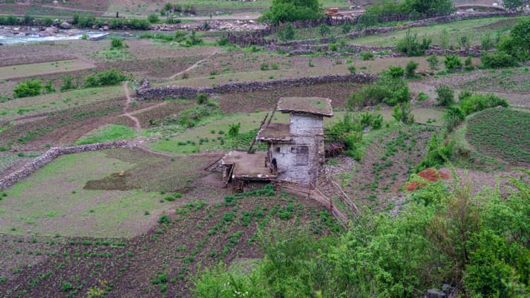
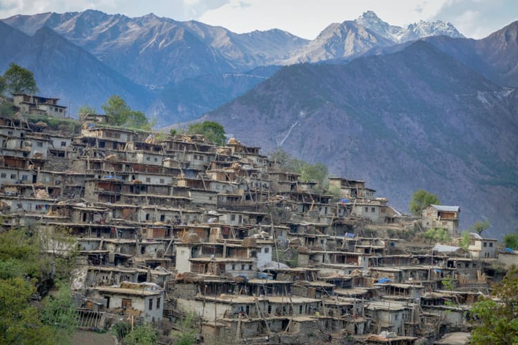
The trail goes through yak pastures, cultivated land, along rivers and water falls, down ravines and through interesting villages. At the view point of Yak Kharka (4900 m) there is stunning views of Mount Kailash in Tibet. Until very recently it was possible to continue this trek along the traditional pilgrim trail to Mt Kailash, but this practice has been halted by the Chinese Government. Evidence of the ties between Humla and Tibet can be seen by the prayer flags and mani stones that line the trails as well as the beautiful stone (Tibetan style) villages, and the 1,000 year old Rizing Ling Gompa.
Possible wildlife on view includes marmot, wolf, wild yak, and Himalayan black bears. Of the rare mammals, snow leopards and blue sheep are known to live in this area.
This amazing trek highlights a different side of Nepal than that seen in some of the more usual trekking routes. It also gives a glimpse into the mystical land of Tibet without having to go through the formalities of getting there! The pristine sights and sounds of this trek more than makeup for the challenging hiking with some long days.
Humla Limi Valley Trek Outline Itinerary
Day 1: Kathmandu to Nepalgunj (Flight)
Nepalgunj – 150 m / 492 ft – 1 hr
Day 2: Nepalgunj to Simikot (Flight) to Dharapuri
Dharapuri – 2270 m / 7447 ft – 6 hrs
Day 3: Dharapuri to Kermi
Kermi- 2629 m / 8625 ft – 5 hrs
Day 4: Kermi to Chumsa Khola valley
Chumsa Khola Valley- 3400 m / 11154 ft – 6 hrs
Day 5: Chumsa Khola valley to Dharmashala
Dharmashala – 4000 m / 13123 ft – 7 hrs
Day 6: Dharmashala to Talung
Talung- 4380 m / 14370 ft – 7 hrs
Day 7: Talung to Jang
Jang – 4070 m / 13353 ft – 6 hrs
Day 8: Acclimatization Day
Jang – 4070 m / 13353 ft – 2 hrs
Day 9: Jang to Halji
Halji – 3670m / 12040 – 5 hrs
Day 10: Halji to Til
Til – 3700 m / 12139 ft – 5 hrs
Day 11: Til to Manepeme
Manepeme – 3970 m / 13024 ft – 8 hrs
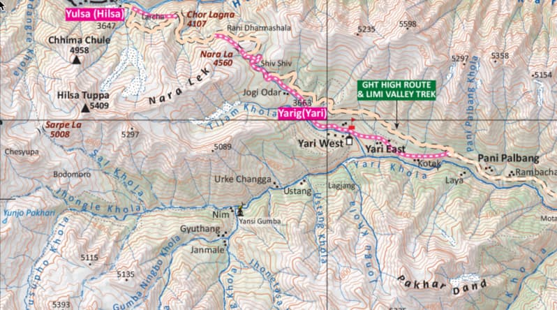
Day 12: Manepeme to Hilsa
Hilsa – 3740 m / 12270 ft – 5 hrs
Day 13: Hilsa to Palbang
Palbang – 3389 m / 11118 ft – 7 hrs
Day 14: Palbang to Muchu
Muchu – 2929 m / 9609 – 4 hrs
Day 15: Muchu to Chumsa Khola
Chumsa Khola – 3400 m / 11154 ft – 5 hrs
Day 16: Chumsa Khola to Dharapuri
Dharapuri- 2270 m / 7447 – 5 hrs
Day 17: Dharapuri to Simikot
Simikot – 2910 m / 9547 ft – 5 hrs
Day 18: Simikot to Nepalgunj (Flight) to Kathmandu (Flight)
Kathmandu- 1300 m / 4265 ft – 3 hr
Not satisfied with this Itinerary?
Are you interested on planning custom trip? It only takes 2 minutes.
Includes
- 16 nights accommodation in tents
- 1 night accommodation in Nepalgunj (Hotel Sneha or similar)
- Guide for 18 days
- Cook for 18 days
- Required number of porters for 18 days
- Kathmandu Nepalgunj Kathmandu flight
- Nepalgunj Simikot Nepalgunj flight
- Restricted area permit
- 18 x set breakfast, 17 x set lunch and 17 x set dinner while on trek
- Lunch and dinner in Nepalgunj


