How Much Distance Do You Have To Hike Everyday in Everest Base Camp Trek?
The Everest Base Camp trek is a two weeks trek. Seems tough!
Not actually.
Let’s take it this way. You travel short distances every day for two weeks to complete the long trek to Everest Base Camp!
Seems better now?
Let me clarify the everyday distance you will be traveling for the Everest Base Camp Trek.
Day 1: Kathmandu to Lukla (Flight) to Phakding
| Flight Distance: | 135 km/ 84 miles |
| Flight Duration: | 30 minutes |
| Walking Distance: | 9 kms/ 5.6 miles |
| Walking Duration: | 4.5 hrs |
| Difficulty: | Easy |
| Elevation | Kathmandu (1,400 m /4,593 ft): Lukla (2,845 m /9,334 ft): Phakding (2,651 m/ 8,698 ft) |
| Elevation change: | 1,445 m / 4,740 ft ascend, then 196 m/ 643 ft descend |
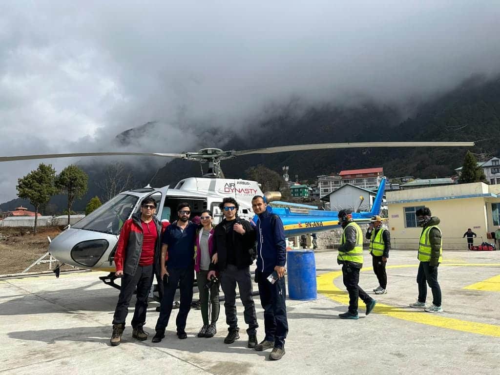
Now (since 2022) that flights to Lukla do not start at Kathmandu but instead leave from Ramechhap, around 4 hour’s drive east of Kathmandu, this ‘easy’ day may have gotten a little bit less comfortable due to the fact you will have probably had less sleep the night before. Having said that, it is a good day to introduce you to trekking in the Himalayas!
Having departed your hotel in Kathmandu around 1 or 2 am and caught the morning flight in Ramchhap around 6 or 7 am, you have landed at the amazing Tenzing Hillary Airport in Lukla. You are at an altitude of around twice that of Kathmandu but well below the height where you need to start to be aware of changes in your body due to the altitude.
We walk downhill from Lukla to Phakding. This is the start of your trekking. As you pass through pine forests, with magnolia trees and some rhododendrons (colourful in the spring season), you will walk for around 4.5 hours.
Tonight you check into your first trekking lodge, a tea house in Nepal. These are often simple accommodations (a few luxury lodges do exist, so ask us if this is your preference) with hot, filling food.
Tip: Get into the habit of drinking plenty of water on the trail.
Highlights of the day: Flying into Lukla, the excitement of your first day on the trek, crossing the Dudh Koshi river by a suspension bridge.
*should you prefer to helicopter into Lukla from Kathmandu, we can organize that for you too.
Day 2: Phakding to Namche Bazaar
| Walking Distance | 9 km/ 5.6 miles |
| Walking Duration: | 5-6 hrs |
| Difficulty | Hard |
| Elevation: | Phakding (2,651m/8,698 ft ) to Namche Bazaar (3,440m/ 11,286 ft) |
| Elevation change: | 789 m/ 2,589 ft ascend |
Although you are walking the same distance as yesterday, Day 2 is a bit harder and longer in terms of hours. This is because we start to ascend quite a bit today. Walking through forests, yak pastures, and across more suspension bridges, we reach the entrance of Sagarmatha National Park. Passing through the tall entrance gate, it seems like you are in the land of huge mountains.
Lunch is taken on the trail today, as it will be from now on. Numerous teashops along the routes offer some tasty meals suitable for lunches. Continuing on the trail after lunch, the final two hours is a steep hill up to Namche Bazaar. Yes, this is probably the bit labeled as ‘hard.’
By the time you reach Namche Bazaar, you may feel some effects of the high altitude (3,400m / 11,286 ft). And it is, for this reason, we insist you spend two nights in Namche, basically to enable your body to get used to the altitude and thinner air.
Tip: Until you get used to the rhythm of trekking, you might not feel hungry. Please ensure you do eat as this is essential fuel. Stuff a few high protein or chocolate bars in your day pack for times you want something ‘homely.’
Highlights of the day: Seeing Mt Thamserku (6,623m / 21,680 ft) towering above you as you enter Sagarmatha National Park, getting used to those high suspension bridges, and experiencing lunch on the trail for the first time.
Day 3: Acclimatization day (Day trip to Khumjung)
| Walking Distance | 16 km/ 10 miles |
| Walking Duration: | 5 hrs |
| Difficulty | Medium |
| Elevation: | Namche Bazaar (3,440m/ 11,286 ft) to Khumjung (3,790m/ 12,434 ft ) |
| Elevation change: | 350m/ 1,148 ft ascend |
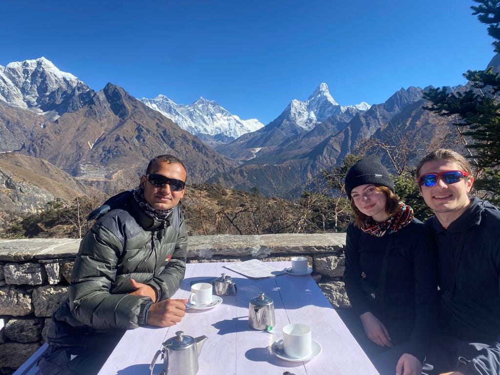
All trekkers and mountaineers spend an extra day in Namche Bazaar, as it is the perfect place to acclimatize to the altitude. Not only is it situated at a height hovering between ‘fine’ and ‘might have a headache,’ but it is also a great place to spend time. Shopping can be done should you have forgotten, or eaten already, those chocolate bars, and getting to know the Sherpa community is something we all enjoy.
But acclimatization doesn’t mean lazing around in the hotel or market. Acclimatization is best done by keeping active. And this is what you came for anyway, isn’t it?
You may not have noticed the stunning mountains surrounding you when you arrived tired the previous day. Your guide will point them out to you today. They include:
Kwangde (6,011m), Thamserku (6,623m), Kangtega (6,782m), Nuptse (7,861m), Lhotse (8,516m), Ama Dablam (6,812m) and, of course, Mount Everest (8,848m).
Your guide will also explain the day to you. Today you will be hiking for around five hours, there and back, to the village of Khumjung. This lies at an altitude slightly higher than Namche and is a great way to get your body acclimatized. Hike high; sleep low, is the saying. Passing through more astounding scenery, the village Khunjung is where Sir Edmund Hillary sets up their school. After his amazing feat of conquering Mt. Everest, he wanted to give back to the Sherpas. We know without the Sherpas, Sir Edmund and every mountaineer after him could not make it up the wild mountains of this area. Today the Sherpa community is better educated and more financially stable thanks to Sir Edmund and people like him.
An alternative, the shorter hike, would be to Everest View Hotel (approx. one hour each way) for a cup of something hot with an amazing view, as the name suggests.
Tip: Enjoy the company of the locals, but do not give gifts to the children directly. You can donate to the school if you wish.
Highlights: The mountains, the people, the buzz of Namche, knowing your body is getting into the trekking routine!
Day 4: Namche Bazaar to Tengboche
| Walking Distance: | 12 km/ 7.5 miles |
| Walking Duration: | 5-6 hrs |
| Difficulty: | Easy-Medium |
| Elevation: | Namche Bazaar (3,440m/ 11,286 ft) to Tengboche (3,870m/ 12,697 ft ) |
| Elevation change: | 430m/ 1,410 ft ascend |
Today’s trail takes six to seven hours but is not difficult as it is mainly through flat(ish) land. The first part of the hike takes you down to the Dudh Koshi river, but the second half takes you back up, ascending gradually via a switchback trail to Tengboche for two to three hours.
By now, you will have noticed Tibetan Buddhism heavily influences the Everest Region. Prayer flags, stupas (shrines), and mani walls (stone dykes with Buddhist mantras/ prayers carved into them are everywhere.
When you finally reach the monastery at Tengboche, the surrounding panorama will take your breath away. Here, at the highest monastery in the region, lie astounding views of Ama Dablam, Nuptse, Lhotse, Thamserku, and Everest. Take in the views, relax in the sounds of daily rituals held by the monks, and wonder how all this beauty is possible here on earth.
Tip: Please ask your guide if it is possible to enter the monastery to witness a puja (ritual). This will depend on the time of day.
Highlights of the day: A perfect day for photography. You are not too tired, and the mountains are so impressive from this location—lighting lamps at the monastery for your loved ones.
Day 5: Tengboche to Dingboche
| Walking Distance: | 12 km/ 7.5 miles |
| Walking Duration: | 5 hrs |
| Difficulty: | Easy-Medium |
| Elevation: | Tengboche (3,870m/ 12,697 ft ) to Dingboche (4,360m/ 14,304 ft.) |
| Elevation change: | 490 m/ 1,608 ft ascend |
The trail is mostly downhill with periods of flats today, which makes us think it is a relatively relaxed hike. But with the high altitude, everyone may be more out of breath than usual. Dingboche is the highest Sherpa settlement in the area; here, we will take another acclimatization day.
On the trail, we notice that the pine forests have now disappeared, and the vegetation is smaller and shrub-like. Descend to the Imja River, cross the river, and start the final uphill walk. On the way, we stop for lunch, probably at Shomare, three hours out of Dingboche. We will stop at Dingboche for two nights, again, to let our bodies get used to the height.
Tip: By now, you will have noticed that for every downhill, there is an uphill climb in the Himalayas!
Highlights of the day: The change in the vegetation from alpine to mountainous terrain has begun.
Day 6: Acclimatization day (Day trip to Nagarjun Hill)
| Walking Distance | 5 km/ 0.62 miles |
| Walking Duration: | 4 to 5 hrs |
| Difficulty: | Hard |
| Elevation: | Dingboche (4,360m/ 14304 ft.) to Nagarjun Hill (m/ ft ) |
| Elevation change: | 0 m/ 0 ft ascend and descend |
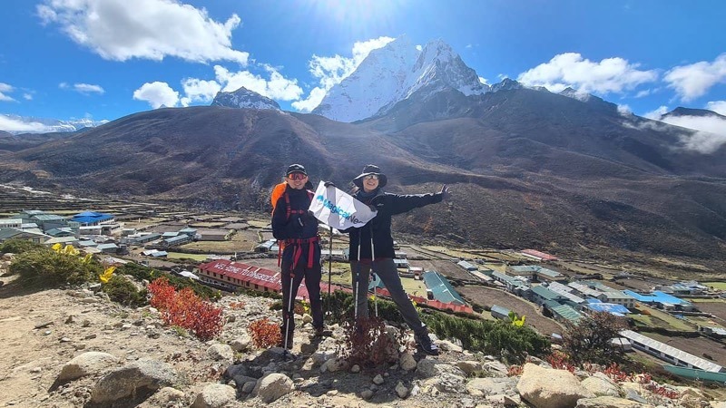
Wake up this morning in the beautiful surroundings, and in the knowledge, today’s hike may be difficult, but the rewards are great. Ama Dablam, Island Peak, and Lhotse are just some rewards. Another might be that the afternoon is free for you to relax and catch up with journaling, chatting, or simply being.
Tip: Keep hydrating, and keep moving.
Highlights of the day: Hiking high to witness even more wonderful views. Followed by an afternoon of relaxation!
Day 7: Dingboche to Lobuche
| Walking Distance: | 12 km/ 7.5 miles |
| Walking Duration: | 5-6 hrs |
| Difficulty: | Hard |
| Elevation: | Dingboche (4,360m/ 14,304 ft.) to Lobuche (4,940m/ 16,207 ft) |
| Elevation change: | 580m/ 1,903 ft ascend |
Today’s trek starts with a gentle climb towards the Pheriche Valley through alpine scrub above the valley floor. The view of Ama Dablam is amazing as the mountain seems to rise straight out of the valley floor itself. Then it becomes harder as the trail’s steepness and the altitude’s thin air kick in.
Ascending Dughla Pass, you will come to a memorial for mountaineers who have died climbing in this region. Your guide will be able to explain some of the more famous or, say, infamous stories to you. Walking on glacier moraine now, there are panoramic views of peaks over 7,000m as we go over the Thokla Pass. Nuptes, Lhotse and Lhotse Shar are just some of the names you may recognize. An hour later, we reach Lobuche.
Even the hardiest trekker is grateful to reach the simple settlement of Lobuche. This is where we sleep tonight. Not very attractive, the settlement has a wonderful placement among stunning and dramatic scenery.
Tip: Even the ‘hard’ walking days bring beauty.
Highlights of the day: Hiking over the Thokla Pass is an achievement. The views from the Thokla Pass. Being humbled at the Dughla Pass memorial.
Day 8: Lobuche to Gorak Shep (Day trip to EBC)
| Walking Distance: | 10 km/ 6.6miles |
| Walking Duration: | 7-8 hrs |
| Difficulty: | Hard |
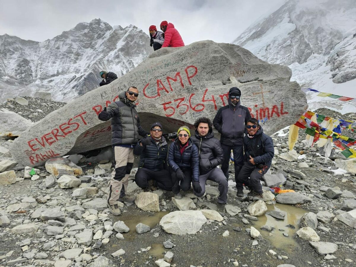
| Elevation: | Lobuche (4,940m/ 16,207 ft) to Gorak Shep (5,170m/ 16,962 ft ) to EBC (5,368m/ 17,612 ft) |
| Elevation change: | 230m/ 755 ft ascend and 198m/ 650 ft ascend |
Having arrived at Gorakshep after three hours of walking across rough ground and boulders, we have lunch at this small settlement. After lunch, we head for Kalapattar. This is the highest altitude we can trek to in Nepal (any higher requires a climbing permit!).
For us, this is a highlight of the trek. We see a wonderful panorama of mountains before us from atop this high rock ridge. Here we get a good look at the awe-inspiring Himalayas, including Mount Everest.
Being that it is the Himalayas, if the weather is not clear in the afternoon, your guide may decide to wait and climb Kalapattar in the morning for clearer weather and sunrise. In case it is decided not to head up Kalapattar on this day, you will head to Everest Base Camp instead.
Tips: Always follow your guide’s advice.
The highlight of the day: The almost perfect views of the mountains.
Day 9: Gorak Shep to Pheriche (Morning trip to Kala Patthar)
| Walking Distance: | 13 km/ 8 miles |
| Walking Duration | 7-8 hrs |
| Difficulty: | Hard and then Easy |
| Elevation: | Gorak Shep (5,170m/ 16,962 ft ) to Kala Patthar (5,545m/ 18,192 ft) to Periche (4280m/ 14042 ft) |
| Elevation change: | 375m/ 1,230 ft ascend, and 1265m/ 4150 ft descend |
Today we either head to Everest Base Camp or Kalapattar, depending on the weather yesterday. At base camp, we are up close to Everest, so the views here of this majestic mountain are not as stunning as those from Kalapattar. But this is base camp! Of the world’s highest mountain! You made it!
It takes around 3 to 4 hours to trek from Gorakshep to Base Camp (and the same amount of time to travel from Gorakshep to Kalapattar). On return to Gorakshep, we take breakfast and collect our belongings before heading for our next overnight stop at Pheriche. Again, this is around a 4-hour hike.
Tip: Don’t try to interact with mountaineers – they are on their mission!
The highlight of the day: Being able to say you have been to Everest Base Camp!
Day 10: Pheriche to Tengboche
| Walking Distance: | 16 km/9.9 miles |
| Walking Duration | 6-7 hrs |
| Difficulty: | Strenuous |
| Elevation: | Pheriche (4,371m / 14,340 ft) to Namche (3,440m / 11,286 ft) |
| Elevation change: | 931m / 3,054 ft descent |
The trail today descends considerably. But since this is the Himalayas, there are uphills also! As we approach Namche Bazaar, the vegetation changes and grows greener with pine forests. Finally, we reached Namche with its lively atmosphere, good food, better Wi-Fi, and beer.
Tip: Be prepared for a day hard on the knees.
The highlight of the day is having a cold beer or glass of wine with dinner.
Day 11: Namche to Lukla
| Walking Distance: | 16 km/9.9 miles |
| Walking Duration: | 5-6 hrs |
| Difficulty | Strenuous |
| Elevation: | Namche (3,440m / 11,286 ft) Lukla (2,845 m /9,334 ft) |
| Elevation change: | 595m / 1,952 ft descend |
We are sad to leave the mountains behind us as we make our way from Namche to Lukla. Although this is not too strenuous of a day – except on the knees again – we perhaps feel very heavy as we make our way down the trail toward the end of the trek.
Tip: Literally tips! Do you want to tip your guide and porters? It is customary.
The highlight of the day: While sad to leave, you feel a great sense of achievement.
Day 12: Lukla to Kathmandu via Ramechhap (Flight)
| Walking Distance: | 16 km/9.9 miles |
| Walking Duration: | 5-6 hrs |
| Difficulty | Strenuous |
| Elevation: | Namche (3,440m / 11,286 ft) Lukla(2,845 m /9,334 ft) |
| Elevation change: | 595m / 1,952 ft descend |
It’s never easy to say goodbye to the Himalayas, your guide, trekking staff, and fellow adventurers. Thankfully you have time in Kathmandu to meet with your guide and fellow trekkers before you all head off to new adventures. But today, it is time to say goodbye to Mt Everest and the other mountains in this area.
Flights depart in the early morning from Lukla to Ramechhap, then travel by road back to Kathmandu, arriving in the afternoon. For those returning by helicopter, you will be back in Kathmandu in time to have lunch before checking into your hotel.
Tip: Take a pre-ordered helicopter out of Lukla and save time!
The highlight of the day: The mountain views as you fly over the Khumbu for the last time.
Alternatives
Even if you are not in tip-top shape, you can still do the best parts of the Everest Base Camp Trek. How? You can fly out of Gorakshep by helicopter. That will save you two days of trekking and a lot of downhill knee pain! From Pheriche to Lukla, we descend almost 2,500m / 8,200 ft, which is extremely hard on the body over the two-day period.
Catching a helicopter out of Gorakshep is the ideal way for those who want to cut two days from the trip to enable them to manage the shorter trek in more physical comfort. Please get in touch with us regarding helicopters out of Gorakshep and/or out of Lukla.
